Prospector Parson Smith walked hundreds of miles in his years looking for the next big strike of riches. Mineral wealth may be one thing, but wealth of rich natural landscapes never eluded him, particularly not in the Northwest. In 1886 he carved into a tree on the present-day Washington-Canada border in the North Cascades:
"I have roamed in foreign parts, my boys, and many lands have seen. But Columbia is my idol yet. Of all lands, she is queen."
We couldn't agree more.
Though that sign was left farther northwest of our more inland region, the sentiment applies across the board, from the North Cascades across the Columbia River to the Selkirks, Spokane and North Idaho.
Yeah, we live in a pretty darn cool place.
That's not just Spokane, either, or Sandpoint or Coeur d'Alene. Our Inland Northwest area may span two states and more than 100 miles in any direction, but we're cut from the same cloth: Outdoorsy, perhaps more rugged than our western neighbors, always looking for a good time among the trees and hills.
When Outside magazine named Spokane one of its best outdoor towns for 2013, it did so not because of just one hike close to the city, but because the broader region (including North Idaho) is, as the Spokane tourism boosters like to say, "near nature, near perfect."
One of the activities that makes the Inland Northwest so desirable is hiking. Go in any direction, from the craggy peaks of the North Idaho Selkirks to the basalt formations and glacial-flood-formed Columbia Basin to the rolling hills of the Palouse, and you'll find a hike that's just right for you.
Parson Smith may not have carved on any tree in Spokane or Sandpoint or anywhere immediately nearby, but we're confident he would have loved this area all the same. Try out some of these nearby hikes and channel his spirit, imagining you're seeing the same views that people like Smith did so many years ago.
Iller Creek
Location: Iller Creek / Rocks of Sharon / Spokane area
Length: 5-mile loop from Iller Creek trailhead. 2.5 mile up-and-down from Stevens Creek trailhead. Both trails merge at the top, called Rocks of Sharon, with access to Tower Mountain.
Difficulty: Moderate
Getting there: Iller Creek Trailhead: 9000 E. Holman Rd., Spokane: Coming from Sprague Ave. or Appleway Blvd., turn south on Dishman-Mica Rd. Turn right on Shafer Rd. at a stop light. Continue until a stop sign at 44th Ave. Turn right. Take first left onto Woodruff Rd. Turn right onto Holman Rd., and follow uphill until the dead end and parking area with gate and outhouse.
Stevens Creek trailhead: 8901 S. Stevens Creek Rd.
Coming from South Hill / Valleyford on Palouse Hwy, turn left or right (depending on direction) onto Stevens Creek Rd. Drive 3 miles to trailhead, on left.
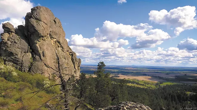
Why we love it: The Iller Creek area offers everything you can ask for in a hike, especially one so close to the city: A diversity of landscapes and vegetation, opportunities for wildlife viewing, a reward at the top worth the climb, and views galore. The newer trailhead on the south side of the mountain — Stevens Creek — is a shorter ascent, but just as rewarding at the top. For a longer hike, start at Iller Creek and ascend in a counterclockwise direction on the loop. You'll go up a stream (riparian) area with dense woods and water-loving vegetation that you won't find on the opposite side of the valley. Follow the loop all the way around until you summit at the Rocks of Sharon, where you may catch rock climbers or scramblers going up the vertical rock outcroppings.
When to go: While this hike is accessible year round (and very popular with mountain bikers), one of the best (and much less crowded) times is in winter. The snow may be hardpacked down below and get icy, so bring snowshoes or ice cleats (such as the popular Yaktrax). The view from the top is just as good in winter, and sometimes when an inversion layer leaves the valley floor shrouded in fog, you'll ascend above it and feel like you're — like that song by the Carpenters — on top of the world looking down on creation.
Steamboat Rock
Location: Steamboat Rock State Park / Grand Coulee area
Length: Various depending on route and side excursions. At least 5 miles.
Difficulty: Moderate to difficult, depending on time of day and distance.
Getting there: 51052 Highway 155, Electric City, Wash.: Follow US Hwy. 2 west toward Davenport. Continue to Wilbur, running right at Hwy. 174 toward Grand Coulee. At Four Corners junction in Grand Coulee (a gas station will be on the right), turn left onto Hwy. 155, following through Electric City. Follow signs to main Steamboat Rock State Park entrance.
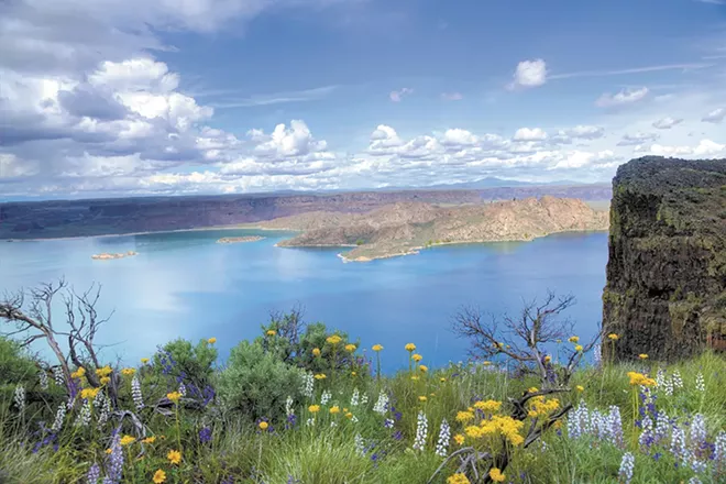
Why we love it: The Grand Coulee and Bank Lake/Lake Roosevelt area make for a worthwhile weekend getaway or day trip. It's a small tourist town (i.e., lots of water activities) with a plethora of hiking. Steamboat Rock overlooks Banks Lake, created as a reservoir to feed the agricultural economy of central Washington. It's a steep hike from the state park campground up through an area that was carved by glacial floods. So you're walking through natural and human history.
When to go: While popular in summer with boaters, Steamboat Rock may best be reserved for late winter and early spring, when ice formations on the surrounding basalt walls can make for cool pictures (or ice climbing, if that's your thing). Bald eagles in and around the state park and nearby Northrup Canyon (part of the larger state park complex) are best seen in mid-February through March.
Kettle Crest
Location: Kettle Crest Trail / Sherman Pass between Kettle Falls and Republic, Wash.
Length: Varies. About 40 miles end-to-end backpacking. Multiple short day hikes possible.
Difficulty: Moderate to difficult, depending on route and length.
Getting there: Main trailhead at top of Sherman Pass on Hwy. 20. More route and hike descriptions from Washington Trails Association: tinyurl.com/WTAKettleCrest
Why we love it: Quite simply, it's the crown jewel of Eastern Washington hiking — and the crowds are nowhere near what you'd find on the Pacific Crest Trail. It's secluded enough to not get the masses from the west side of Washington, but easily accessible enough to allow quick access from the Spokane-Coeur d'Alene region. There are multiple peaks above 7,500 feet that you can scramble up if you have enough time, or just enjoy the expansive, 360-degree views from lower on the trail.
When to go: Though sections of the trail (particularly the branch south of Hwy. 20) are accessible all year, some areas don't melt out until mid-June or even July (obviously not in 2015). The best time to hike is late September to late October, when the weather can be just as nice (and not so hot!) as summer, and the foliage really starts to change.
Tip: Fresh water sources are scarce, with a few springs. But open rangeland in the area means livestock could have access, and you should always filter any water you do collect. In the end, be sure to pack in plenty of extra water from home. The needles of Western larch (or Tamarack) trees turn yellow and fall off, a sight rarely seen in most coniferous forests. When they're blowing in the breeze, take time to appreciate the scenery and think of it as "nature's gold" falling on the trail.
Palouse Falls
Location: Palouse Falls State Park / Starbuck, Wash.
Length: Varies. 1 to 4 miles depending on route
Difficulty: Moderate to difficult
Getting there: From Spokane, take I-90 east to Ritzville and exit 221. Follow Hwy. 261 south, going across Hwy. 26 and the town of Washtucna. Continue south on 261, eventually turning right to remain on 261 and follow signs to the park.
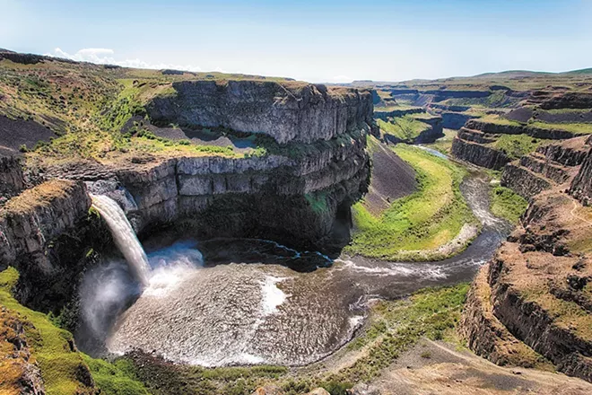
Why we love it: This isn't as much a destination for expansive and amazing hiking, but what it lacks in distance on trails it makes up for with views and cool geology. Palouse Falls seemingly comes out of nowhere in what is otherwise a very remote and, frankly, not particularly scenic farming area. You'll see thousands of years of geologic history unfolding before your eyes, part of the Channeled Scablands that make up much of central and southeastern Washington. Hike from the parking area to the top of the falls or upstream along the Palouse River. The more adventurous can scramble to the bottom of the falls and walk downriver. But as you'll see when you arrive, the scramble down (and up) will be a challenge. Wear good boots with solid traction.
Pulaski Tunnel
Location: Pulaski Tunnel Trail / Wallace, Idaho
Length: 4 miles round trip
Difficulty: Easy
Getting there: I-90 to Wallace, Idaho, exit 61. At stop sign, turn right. Turn left on I-90 Business Route toward Wallace, right on 2nd St. Turn right onto Bank St., which becomes King St. King turns slightly left and becomes National Forest Rd. 456/Moon Pass Rd. Continue on Forest Service Rd. 456 for about a mile until you see the well-marked parking area on your left.
Why we love it: There isn't a spectacular view at the top, but there is a lot of history unfolding before your eyes. The trail is marked along the way with interpretive signs telling the story of Ed Pulaski, a U.S. Forest Service ranger whose actions during the massive 1910 forest fires in the area saved the lives of 45 of his men. As the forest burned around them, Pulaski guided his crew into a mining tunnel along Placer Creek. You're walking part of the same route, and also learning about a very pivotal time in Inland Northwest history, as the fire wiped out much of what was then a thriving mining and timber industry in the area.
Mckinnick Trail
Location: Mickinnick Trail / Sandpoint, Idaho
Length: 7 miles round trip
Difficulty: Moderate to more difficult, with 2,000 feet of elevation gain in 3.5 miles.
Getting there: From Sandpoint, take Hwy. 95 north about 1.3 miles to Schweitzer Cutoff Rd. Turn left and drive a half-mile. Turn right, drive about a mile and turn left on Schweitzer Mountain Rd. (there will be a sign for Schweitzer resort). Turn left at Woodland Dr. Parking area is about a mile down on the right.
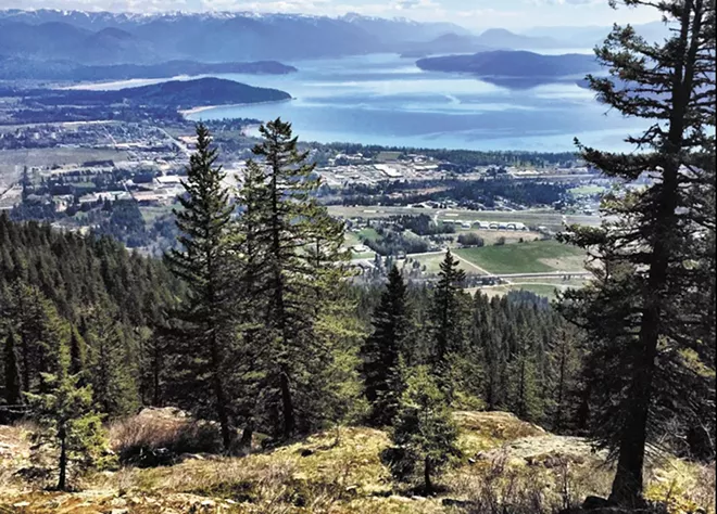
Why we love it: It's close enough to town to do before lunch or in the afternoon before dinner, but gets you high enough to really feel like you're getting away from it all. The trail climbs quickly with many switchbacks, so be prepared to feel the burn going up and coming down. Stop on some of the open corners and look east toward Sandpoint and Lake Pend Oreille, and farther toward Montana and the Cabinet Mountains. The main attraction: huckleberries galore (if you time it right). Bring a Tupperware container to collect the berries in late July through August. But don't be a berry hog (or bear). Save some for your fellow berry lovers.

