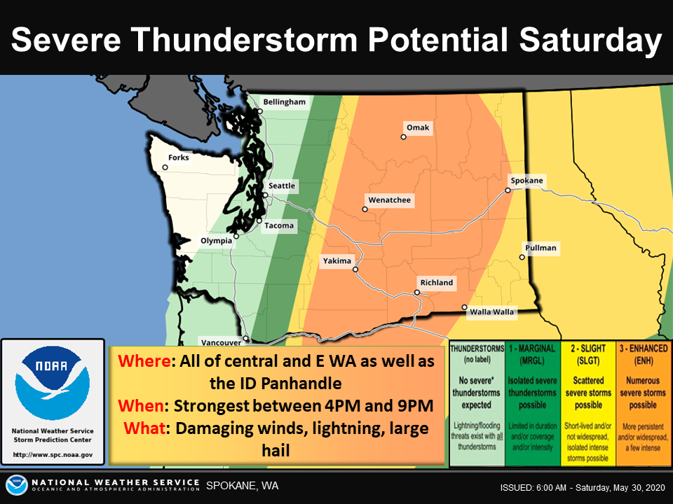
Local weather officials are warning of a pretty gnarly storm passing through the Inland Northwest later this afternoon and evening, bringing with it the potential for baseball-sized hail, damaging winds, torrential rains, flash flooding and even isolated tornadoes.
“This is a fairly big deal,” says Steve Bodnar, in the Spokane office of the National Weather Service. “We don’t see enhanced risks in our area very often. Generally speaking, we think this could be like a 1-in-10 year event.”
According to the weather service, the likely threats from the storm include:
• Damaging wind gusts to 70 mph causing downed trees, powerlines, roof damage.
• Hail up to 2.5" in diameter causing damage to cars.
• Torrential heavy rain causing urban flash flooding and debris flows.
• A small threat of tornadoes.
Bodnar says the storm will reach Spokane between 7 pm and 9 pm. Things are expected to wind down after 9 or 10 pm, but more rain and wind is expected to continue through the night and into Sunday morning.
Watch the video for Bodnar's special weather briefing: