
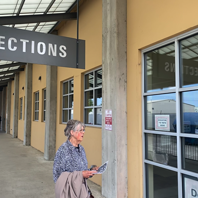
On July 16, Spokane's Manito neighborhood saw afternoon temperatures of 85.2 degrees Fahrenheit. At the exact same time, three miles away, West Central was cooking under 93.8-degree heat.
Two neighborhoods. One eight degrees cooler.
Those numbers come from a new study that collected heat data with help from over 40 volunteers who drove through the city with heat sensors mounted to their cars. At its most extreme, the data showed a 13.9-degree difference between neighborhoods. Overall, the hottest neighborhoods were Emerson/Garfield, West Central and downtown.
The scientific explanation for the divide involves the heat island effect, which is caused by a lack of green space and trees and an excess amount of asphalt and dense buildings.
The political explanation involves money. The pockets of cool temperatures in Spokane closely correlate with the city's more affluent neighborhoods.
"One of the ways of thinking about it is as an environmental justice issue, " says Brian Henning, the director of Gonzaga University's Center for Climate, Society and the Environment, which helped organize the study.
Henning tells the Inlander he wasn't necessarily surprised by the results and is glad to see the data confirm what many already knew anecdotally. Anyone who has walked across a blacktop on a hot day has probably felt the temperature difference.
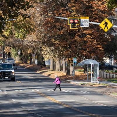
In summer 2021, at least 20 people died in Spokane during a record-breaking heat dome sent temperatures soaring above 110 degrees. In some areas, nighttime brought little relief, as dark surfaces trapped the heat and radiated it back out at night.
"A lot of people in Spokane are used to opening the windows at night, pulling in the cold air and then shutting the windows and blocking out the sun during the day," Henning says. "But it wasn't getting cool enough at night."
Many of the deaths were in poorer neighborhoods that experience higher temperatures. Poverty, pre-existing conditions and a lack of access to air conditioners also likely played a role.
Henning hopes the new data can help inform policymakers and better prepare for future heatwaves. He says the city's plan to use libraries as cooling shelters during this year's heat wave was a good start, but that a more concrete action plan should be implemented in the future. Cool Spokane, a group of local nonprofits and community groups that formed during this year's heat wave, criticized the city's plan as insufficient. Educating people about the dangers of heat, putting cooling shelters in vulnerable communities and strengthening cooling center infrastructure are all important steps, Henning says.
Heat waves are on track to get more frequent and more severe. Henning says preparing for them will require significant, long-term investments.
"The clock is ticking," Henning says. "We really need to make more concrete, developed plans and have educational projects to wrap around that."
Planting trees is a great long-term solution, Henning says. The Lands Council and City of Spokane are working to do that under the SpoCanopy program, and Henning says the group plans to use the new heat map as a guide for where to prioritize their tree-planting efforts. Using white paint on rooftops and cool pavement technology can also make a big difference, Henning says. (Gonzaga is currently using white paint while redoing the roof of the building that houses Henning's office; He says it dramatically reduces the building's air conditioning use.)
Henning says the heat map is just the first step in an ongoing conversation about how to work towards a healthier — and cooler — community. He hopes the data will help put the focus on the communities already experiencing the worst of extreme heat.
The study was funded with a grant from the National Oceanic Atmospheric Organization. KXLY meteorologist Kris Crocker, The Lands Council, 350 Spokane and the City Council's Sustainability Action Subcommittee were also involved in the effort. Spokane is one of 14 cities across the country that are mapping urban heat islands with help from NOAA. Henning says he plans to analyze the data and see how Spokane compares to other cities.
Researchers are following up with a community-wide survey about people's perceptions and experiences with extreme heat. Henning says they're hoping to get a large number of responses from the community, so click here and take it yourself. Participants get entered to win Gonzaga men's or women's basketball tickets.
Study finds Spokane's poorer neighborhoods are hotter during heat waves
Temperatures varied by almost 14 degrees across the city

Gonzaga University
What a heat wave looks like across Spokane.
[


          {
            "name": "Broadstreet - Instory",
            "component": "25846487",
            "insertPoint": "4",
            "requiredCountToDisplay": "4"
          },{
            "name": "Broadstreet - Empower Local",
            "component": "27852456",
            "insertPoint": "8",
            "requiredCountToDisplay": "8"
          },{
            "name": "Broadstreet - Instory",
            "component": "25846487",
            "insertPoint": "12",
            "requiredCountToDisplay": "12"
          },{
            "name": "Broadstreet - Instory - 728x90 / 970x250",
            "component": "27852677",
            "insertPoint": "18",
            "requiredCountToDisplay": "18"
          },{
            "name": "Broadstreet - Instory",
            "component": "25846487",
            "insertPoint": "5th",
            "startingPoint": "23",
            "requiredCountToDisplay": "24",
            "maxInsertions": 100
          }


      ]


Valleyfest @ Mirabeau Point Park
Sat., Sept. 21 and Sun., Sept. 22

About The Author
Nate Sanford
Nate Sanford is a staff writer for the Inlander covering Spokane City Hall and a variety of other news. He joined the paper in 2022 after graduating from Western Washington University. You can reach him at [email protected]

Digital Edition
- September 19-25, 2024


© 2024 Inlander
