If the Columbia River's mouth eluded some of the most seasoned Northwest explorers who overlooked it, or mistook it for a bay or a section of rough coast, locating the river's headwaters was also a challenge.
Unlike the river's outlet, the Columbia gained its 1,200-mile momentum in the Rocky Mountain trench between the Rockies and Purcell ranges in the deep Northwest interior of eastern British Columbia. And oddly, if explorers expected the big river to turn south or west, it confusedly runs north for some 200 miles until it does a tight hairpin turn and begins its long roll to the Pacific. Looking at a simple map of the river's course, it looks like someone has untwisted a paperclip and left in more than one Big Bend.
The Sinixt [pronounced sin-eye-ext] people's traditional lands extend from Kettle Falls and the Colville Reservation in the U.S. to the Columbia's hairpin turn at Mica in the north. Sinixt storyteller Marilyn James tells of the river's origins: Coyote once met and fell in love with Rain. Rain fell for Coyote and ripped out her heart for him, and where her heart landed became the headwaters of the Columbia, and the blood that flowed from it was the river.
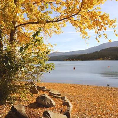
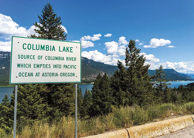
The river is indeed the region's lifeblood. Today its headwaters are acknowledged as Columbia Lake, an 8-mile-long body of relatively shallow water. When the first white fur traders came over Athabasca Pass from modern-day Alberta just to the north, they built a trading post, Kootenae House, near present day Invermere, B.C. They essentially set up camp close to what turned out to be the origin of the great river they were looking for — without knowing it. David Thompson, a Welsh-Canadian fur trader and surveyor who led the group in the early 1800s, was sent to explore and survey the unmapped region, exploit its fur-bearing resource, and figure out where the Columbia started and follow it to its mouth.
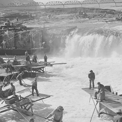
In 1811, Thompson and his exploring party became the first known Europeans to navigate the Columbia's entire length. They were the first whites to travel from Kettle Falls (later drowned in Grand Coulee Dam's Lake Roosevelt in 1940) to the river's junction with the Snake River near the present-day Tri-Cities. The comparatively placid, dammed river we know today was rough going back then with falls and rapids, but Thompson's trip was not only in service of the fur trade and finding a route to the Pacific, but also of laying claim to the region ahead of competing American colonizers, spurred in part by the explorations of Lewis and Clark. Thompson mapped much of the Columbia drainage in western Canada, Idaho, Montana and Washington.
Reading accounts of Thompson's ventures in the region, one gets the sense of its remoteness and isolation. Even today, this stretch of mountain ranges, valleys, rivers, lakes and fjords is complex, beautiful and still encased in wilderness. For many Americans, the Columbia River just disappears from thought and view north of the U.S. border. But nearly 400 miles of the river runs through this spectacular country.
Even for a seasoned adventurer like Thompson, who was often reliant on the aid of local First Nations peoples for survival, the region carried a whiff of the primeval. During a trek over Athabasca Pass to the west side of the Rockies, Thompson's party encountered a fresh set of footprints in the snow, which his Indigenous companions believed had been made by an elephant-like creature that, as tradition had it, lived in the area. It was said to be about 18 feet high and to sleep standing up, sometimes leaning against trees. It was not a carnivore but a vegetarian. Thompson thought the tracks could have been made by an old grizzly with worn claws, but had his doubts.
Throughout the 19th century there were rumors that woolly mammoths might still wander the north lands. Author Jack Nisbet, who followed in the footsteps of Thompson for his book Sources of the River, has written "It's hard not to be intrigued by this account. The Whirlpool [River] drainage does have an Ice Age look about it, and it has the room, the vast empty spaces that it would take to harbor an outsized relic."
Indeed, this part of Canada still gives us a look at the era of glaciation that shaped so much of the Pacific Northwest — and continues to. The Columbia starts here with rain, snow and glacier melt. The vast Columbia Icefield in the Rockies straddles the Continental Divide between Alberta and B.C. Its meltwater eventually feeds into three oceans: the Arctic, the Atlantic and the Pacific. You can view it from the Icefield Parkway between Banff and Jasper National parks. The mountains here dwarf visitors, even mammoth-sized ones. One can appreciate its scale by walking on one of the Icefield's big toes, the Athabasca Glacier at its eastern base.
"Canada's Columbia Basin contributes some 30% to 40% of the Columbia River's total runoff from snow and ice."
The Columbia Icefield supplies water to the North Saskatchewan, Athabasca, Fraser and Columbia rivers. It is thought to have formed some 200,000 years ago during Illinoian glaciation, which reached as far south as Illinois. Like many glaciers and icefields that feed the Columbia, the Icefield is shrinking. So too are British Columbia's glaciers.
Canada's Columbia Basin contributes some 30% to 40% of the Columbia River's total runoff from snow and ice. The future of the Northwest's freshwater supply, irrigation, fish habitat and hydropower partly lie here. A study in the journal Science, published in 2023, concluded that most glaciers in western Canada will be gone in 80 years due to warming global temperatures. Due to drought and decline in snowpack, hydropower production has been down significantly, though demand is rising.
"Roll on, Columbia" is a phrase that can't be taken for granted. The generation being born now might be the last to know the river and its headwaters as we have known them. ♦
Knute "Mossback" Berger is editor-at-large for Crosscut.com, where this first appeared.


